

Files
Download Full Text (716 KB)
Description
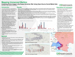
The use of unmanned aerial vehicles (UAVs), or drones, has expanded significantly in modern warfare, reshaping operational dynamics by enabling precision strikes while reducing personnel risk. At the same time, the growth of open-source and social media–based reporting has created new opportunities to analyze military activity through publicly available information. This study examines whether patterns in social media–reported drone strikes can provide meaningful insights into operational behavior in the Russia–Ukraine war.
Using open-source intelligence (OSINT) collected from Telegram posts between September and October 2025, this research compiles documented drone strike events conducted by both Ukrainian and Russian forces. Much of the publicly available footage analyzed consisted of propaganda-oriented content intended to showcase military successes, recruit support, or influence public perception, which introduces potential biases into the dataset. Each incident was categorized by target type, drone type, location, and time of occurrence. The dataset was analyzed using Geographic Information Systems (GIS), including heat mapping and Space-Time Cube modeling with a 10 km radius and three-day temporal intervals to assess both spatial clustering and temporal persistence.
The results show distinct operational differences between the two actors. Ukraine conducted a higher number of strikes overall, primarily targeting infantry and engaging in drone interception activity. Russia employed a broader range of drone types and targeted a wider set of assets, including infantry, equipment, and military bases. Ukraine also demonstrated significantly higher interception rates. Both sides exhibited long-range strike capabilities, with Ukrainian strikes extending deeper into Russian territory.
Space-Time Cube analysis indicates that Ukrainian drone activity is generally more dispersed and temporally limited, while Russian operations are more concentrated and persistent within specific zones, suggesting sustained operational pressure. Heat map results further illustrate clustering in key contested regions, particularly Luhansk, Kharkiv, and Donetsk oblasts.
Taken together, these findings offer knowledge of how each country integrates drones into broader operational objectives. This study demonstrates how OSINT and GIS techniques can provide insight into observable patterns of modern drone warfare, while recognizing that the dataset reflects only publicly available information and not the full scope of military operations
Publication Date
5-18-2026
Document Type
Poster
City
Grand Forks, ND
Keywords
Drone warfare, open-source intelligence, social media analysis, strike analysis, heat map
Disciplines
Geographic Information Sciences
Recommended Citation
Barral, Kayla; Pedersen, Carter; and Stevens, Elise, "Mapping Unmanned Warfare: Analyzing Drone Usage in the Russo-Ukrainian War Using Open-Source Social Media Data" (2026). Arts & Sciences Undergraduate Showcase. 28.
https://commons.und.edu/as-showcase/28
Comments
Presented at the Fall 2025 Arts & Sciences UNDergraduate Showcase in Grand Forks, ND, Dec 11, 2025.