

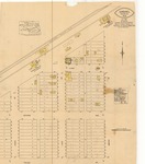
Cashel, 1919
Description
Cashel, North Dakota, in 1919. The map has a scale of 50 feet to 1 inch and is 25 x 21 inches in size. It is similar to maps published by the Sanborn Map Company, although this one was created by Walter I. Fisher.
This paper has been withdrawn.