

Preview
Identification #
OGL291-260
Description
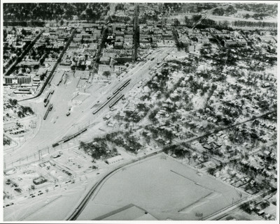
This black-and-white aerial photograph captures a snow-covered landscape dividing the early infrastructure of Grand Forks. Cutting diagonally through the center of the frame is a sprawling railroad yard network, complete with multiple tracks and several long trains parked or moving along the lines.
To the left of the rail corridor lies a commercial and institutional area. On the right of the corridor is a tree-lined residential neighborhood that is blanketed in a heavy layer of winter snow, with snow-packed streets and grid-pattern blocks extending into the distance.
The background shows the Red River of the North running parallel to the top of the image; a sliver of East Grand Forks is visible on the far side, linked to Grand Forks by the DeMers Avenue bridge in the top center.
Places Depicted
Grand Forks, North Dakota
Rights
Elwyn B. Robinson Department of Special Collections, Chester Fritz Library, University of North Dakota, Grand Forks