

Files
Description
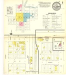
1910 map for Hillsboro, North Dakota. Scale of 1:600 (50 feet=1 inch). Three total pages, each measuring 64 x 54 cm. Index, key, and boundaries for all pages included on the first page.
Publication Date
9-1910
Publisher
Sanborn-Perris Map Company
Keywords
Hillsboro, Traill County
Rights
The Chester Fritz Library provides access to these materials for educational and research purposes. Rights assessment remains the responsibility of the researcher.
Recommended Citation
Sanborn Map Company, "Hillsboro, 1910" (1910). Sanborn Maps of North Dakota. 154.
https://commons.und.edu/sanborn-maps/154