

Preview
Creation Date
1939
Identification #
OGL291-252
Description
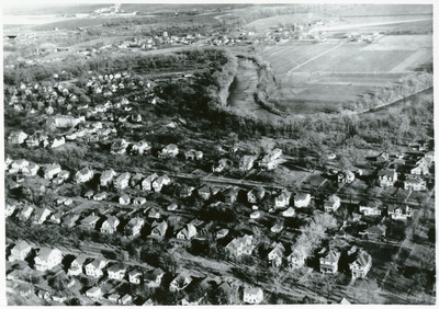
Taken in 1939 by the Grand Forks Herald, this high-angle, black-and-white aerial photograph showcases the landscape of the Red River Valley, capturing the north end of Grand Forks alongside East Grand Forks, Minnesota.
In the foreground and left half of the frame, a dense residential neighborhood spreads across Grand Forks, tightly packed with single-family homes, detached garages, and tree-lined streets. Snaking through the upper portion of the image is the heavily wooded banks of the Red River of the North, which serves as the natural border between the two states. In the upper left corner, the river forks off to form the Red Lake River. Across the riverbanks to the east, the urban density transitions abruptly into the flat, expansive agricultural fields and early outlying developments of East Grand Forks.
Rights
Elwyn B. Robinson Department of Special Collections, Chester Fritz Library, University of North Dakota, Grand Forks