


EERC Maps and Infographics
Publication Date
4-2012
Files
Download Full Text (30.2 MB)
Description
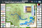
Map of oil wells in western North Dakota. Includes wells with a spud date prior to April 2012. Map sponsors are illustrated by company logos.
Geographic Location
North Dakota
Keywords
Oil wells, Oil well drilling, Bakken Formation, Three Forks Formation
Material Type
Maps
Publisher
University of North Dakota. Energy and Environmental Research Center
Extent
1 map (PDF/A, 30.2 megabytes)
Repository
University of North Dakota, Energy & Environmental Research Center, Library & Information Services. 15 North 23rd Street, Grand Forks, ND 58202. eerclibrary@undeerc.org.
Identifier
1911212
Recommended Citation
University of North Dakota. Energy and Environmental Research Center, "Regional Drilling Activity in the Bakken and Three Forks Formations" (2012). EERC Maps and Infographics. 11.
https://commons.und.edu/eerc-maps/11